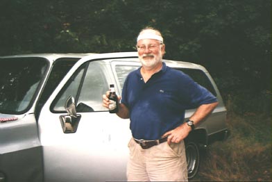
Because I have to make a trip to Dallas on Wednesday, September 1, my plans get screwed up a bit. Instead of sneaking out early on Friday (sorry, Rick!) to hop in the car and drive off to North Conway, there to meet Bobby late Friday night, I do not get home until about 11 p.m. on Friday. Bobby has already arrived at the house, planning to sleep there and then move on to New Hampshire in the morning.Andreas and his son are also there, so there is the unfamiliar hint of Y-chromosomes in the air. Louise and Toni are in bed and Madeline is sleeping over at Rachel’s – perhaps to escape the all-pervading air of masculinity. I throw a few things together – I usually spend hours planning these trips and am embarrassed to be so sloppy, but I need to sleep, so a haphazard packing is all that is possible if we are to leave rested but early in the morning.
At 5:30, I arise, shower and wake Bobby. We load the cars and get on our way before 6:30. I still have not had a definitive conversation with Rick – his last declaration on the subject was that he would arrive on Tuesday and we should plan to hike together.His secretary, however, knows nothing of his plans to be away next week, and I suspect that things have not really gelled for him. He had called on Friday and left a number, but I was unable to reach him there.
The traffic is surprisingly light for a holiday weekend and we make good time, although both of us are fighting sleep for the first hour or so. But by lunchtime, we are pulling into a BBQ place near Conway and are soon at Forest Glen Inn.
We then have to decide whether to make a hasty departure this afternoon or plan a trip starting Sunday morning. Bobby points out that he didn’t come all this way to sit with me in a motel room, and so we launch into hasty planning mode. I check out the maps I threw in the car and find that the only ones I put in were two identical copies of the AMC presidential range map. Well, that certainly helps focus our deliberations, and soon we have decided on the southern end of the Montalban Ridge, which starts in the north at Mount Washington, goes over Boott Spur and then roughly south to Glen. We’ll start in Glen, having stashed a car further down the road so we can do a circuit, and head north up the ridge. By the time we have packed our packs, bought additional food, driven past Glen to stash the car, then back again to the trailhead, it is nearly five o’clock.
The first peak is Mount Stanton. It isn’t very high, but the trail up is pretty steep. Near the top, we meet a couple who also started out late and are considering camping there. We push on to the next peak on the ridge, Mount Pickering. The weather has been hot and humid and we have been dripping with sweat, but on the top we encounter a little breeze which helps reduce the stifling effect of the high humidity. The sky is clear and we decide not to put up the tent but just lie out under the stars. We eat some cheese and sausage and sip a little bourbon. The night is warm and we don’t need a lot of bedding, although we end up spending a lot of time zipping and unzipping our bags trying to find the perfect balance.
We awake well rested at 7:00 the next morning. Our main preoccupation at this point is conserving water, which is normal when hiking on a ridge but made more difficult by the drought which has made established supplies dry up. One of the unfortunate casualties of the drought has been the blueberries – the bushes are everywhere, but not a berry in sight. Apparently, there has been a blueberry crop but it was unusually brief. The weather is still fair, though still hot and humid. We are on the trail before 9:00 – a new world’s record, at least for us. Our goal is to go over Mount Langdon to the Langdon shelter, arriving around lunchtime. We are hoping that the shelter will have a supply of water and when we arrive, a family who stayed the night there tells us that we are in luck. They were hiking with their dog and ran out of water a while before they arrived at the shelter the day before. The dog drank hugely when they found the spring and then fell over and wouldn’t move for several hours, so their plan to go on to the next shelter had to be jettisoned while they waited for him to recover. They had heard and seen a moose the previous evening, quite close to the shelter.
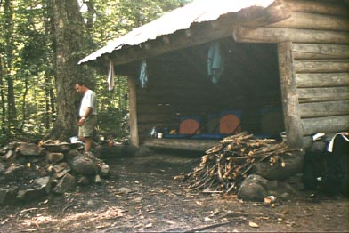
|
| Langdon Shelter |
Our main encounter with the creatures around us on the hike was when we passed a wasp’s nest on the ground. I passed it unscathed, but probably got them riled up so that, when Bobby arrived, they were waiting for him. And they say that Texans cannot move fast! I proudly went to my pack and brought out a vial of bug-sting-fixer-upper, but Bobby noted that it had an expiration date of 1981. He used it anyway, but I’m not sure it did much good.
After lunch, we continue up the ridge, which gains quite a bit of altitude going up Mount Parker. We then have a long stretch of up and down, going towards Mount Resolution. Many of the trees are damaged, we are told, as a result of the great ice storm of 1997, which has also affected the path. Not only are there a lot of tree limbs obstructing the way but the undergrowth has also been invigorated by the increased sunlight, so that it is quite hard to see the trail. We have resolved to stop short of the summit on a scenic outlook that turns out to be gorgeous – 360 degree views, including a good shot of Mount Washington with the summit buildings visible on top. We pitch the tent up on top and, feeling pretty trashed after a long day’s hike, I soon turn in. I try to bring a cup of bourbon with me in the tent for medicinal purposes, but only succeed in spilling most of it over myself and my sleeping bag. Bobby, fortified by his week-long hiking in Washington state just a week ago, is made of sterner stuff and sits outside counting stars for a while before joining me in the tent.
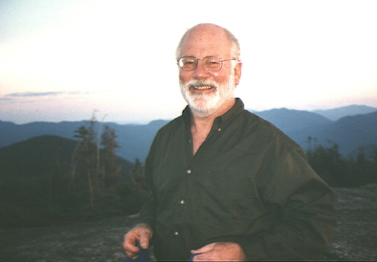 |
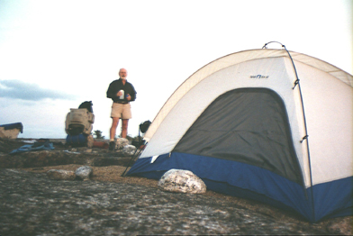 |
| Bobby looking pleased with himself | Our camp site |
Next morning, I feel greatly restored. Bobby has to make it back to Larchmont tonight so he can arrive at work at a reasonable hour on Tuesday, so he has to get out early. We do make a detour over to Resolution shelter where a fellow hiker told us we would be able to find water. We fill up and then switch to the Davis path which leads us back to route 302. The trail was originally created as a money-making venture, hauling rich folks up to the top of Mount Crawford by mule, which gives me new admiration for mules – the path is pretty well-constructed, but it is quite steep and the footing not easy. We stop off where the trail branches off to the summit of Mount Crawford, eat lunch and then drop our packs and dash unencumbered for the summit. The northern side of the summit is sheer cliff – quite spectacular. Then we follow the mules back down the trail to the parking lot where Bobby’s truck is waiting for us with a six-pack.
 |
| The pause that refreshes |
We pick up the Honda, return to Forest Glen Inn and Bobby takes a quick shower before starting his trip home. I don’t envy him – I struggle hard to stay awake but finally succumb to sleep by 8:00 o’clock.
Tuesday is not terribly promising – it has rained during the night and looks like it is going to shower on and off during the day. That is fine – I am using this for rest and recuperation. I talk to Rick – it turns out he had hoped to join us on the trail over the weekend, but we had already left. Having missed that, he claims pressures of work will not let him come up during the work. I snort a bit about his screwed-up sense of priorities, but accept that I’ll have to somehow make it through the rest of the week alone. I am able to get some work done for GE and send it off to them by e-mail. I also do some shopping and buy some new bug-sting-fixer-upper.
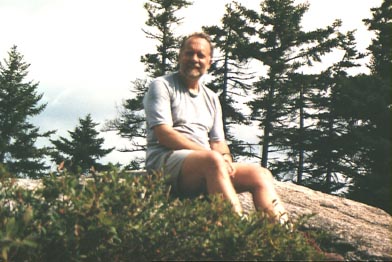
Wednesday looks better. I call Kurt Winkler and set up a climb for tomorrow and then decide on a small hike for today. I don’t want to overdo it – I have a couple of sore heels and don’t want to aggravate them. So I pick Hedgehog Mountain, over near Passaconaway. I get out there by 10 and am hiking by 10:30. It is still pretty humid, and I am sweating profusely. The trail starts at the Brook trail which goes up Passaconaway, and then branches off it to the left. The Hedgehog trail is actually a circuit, which I follow counterclockwise. The trail is soft underfoot and not too steep and by noon I am on the summit, admiring the great bulk of Passaconaway and other nearby mountains. There is no sign of the drought here – little streams seem to be everywhere and, contrary to the laws of physics, there is a little pond on the top of the mountain.After lunch, I start down, as the sky clouds up and starts to look a little threatening. The second leg of the loop is somewhat longer than the first, but it goes past the East ledges, which are magnificent. It would be a great hike for the girls, I think, since it is not too long or difficult but has some real payoff.
 |
| A self-portrait taken on Hedgehog Mountain |
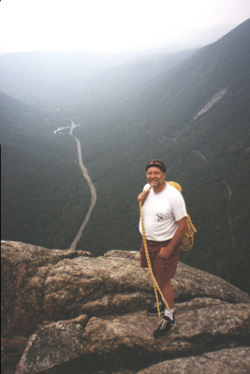
Although there has been more rain during the night, the morning starts clear and dry. Kurt arrives at 8:30 and we set off to do the Pinnacle Buttress on Mount Washington. The simplest approach is to take the auto road about 1/3 of the way up the mountain, park and hike down about an hour to the bottom of the cliff. However, when we get to the auto road, we are told that it is closed all day for repairs. The only other way of getting there is to start at Pinkham Notch, hike up 2.5 hours and then back down after the climb. Since I have not brought my climbing boots and there is barely enough daylight left for 5 hours of hiking and 5 hours of climbing, we change plans and head for Mount Willard in Crawford Notch instead. We stop at a parking lot near a pond, not far from the Willey House and walk down the train tracks to the beginning of the climb. We do Across the Universe, rated 5.10, but avoid the 5.10 crux on the first pitch. It is mostly friction – the rock starts out as good slabs with a lot of texture. Altogether, the climb is 13 pitches, although some of them are pretty weird and involve hanging on to clumps of vegetation for support. We lunch in a little wooded band about half-way up and then resolve to cut across left to the Crawford Cave. The rock is much less pristine here and the first pitch after lunch a very strenuous 5.9, with sharp and crumbly rocks snapping at our heels. We eventually find the cave, which is awesome. Legend has it that the early settlers were constantly on the lookout for the great reserves of gold that the Indians were assumed to have hidden from the sight of the white man. One night, someone claimed to see a golden glow coming out of this inaccessible cave on the cliff, and Crawford had himself lowered by rope from the top of the mountain to explore. He reported no gold but a pile of bones, which was almost as intriguing, although subsequent explorers have only found rocks.
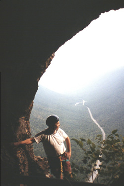 |
 |
| Me at the opening to Crawford Cave | At the top of the cliff |
After a photographic pause, we continue to the top and then take the hiking trail down. The cliff is pretty high – about 800 feet – although it lacks the sheerness of Canon. I’d pass on the crumbly stuff in the future.
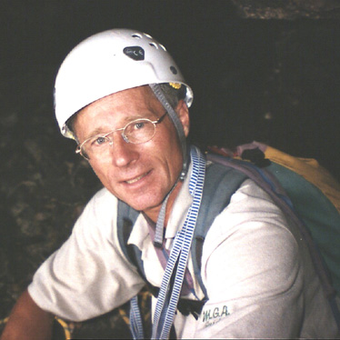 |
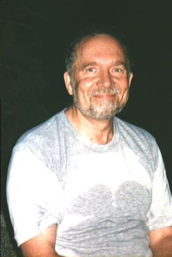 |
| Kurt Winkler | Me sweating and smiling |
Friday starts off raining hard and shows no sign of abating, so I decide to start back home. It rains pretty much the whole way, although the driving isn’t too bad. Lot of accidents, though – one disabled vehicle, one minor fender-bender but three fairly serious-looking accidents with fire trucks and ambulances. I arrive back in Larchmont around 5, and am reunited with my family.